| March 14, 2022
"Within the Bills": EEBO and the Early Modern London Metropolis
One of the more helpful digital databases for the study of early modern history is Early English Books Online (EEBO), which contains images of most of the surviving books printed in England between 1473 and 1700. It builds upon the cataloging work of 19th-century bibliographers and began its life as a collection of microfilm in the late 1930s and 1940s before being digitized at the turn of the twenty-first century.1 Because its focus is on books rather than broadsides or bills, EEBO only contains a small fraction of the early modern Bills of Mortality but a keyword search for the bills still turns up almost 500 results. Perhaps unsurprisingly, these are largely publications that mention the bills rather than the bills themselves. However, it is interesting that these publications are not discussing the bills as a source of quantitative data on mortality. Instead, they are using the bills as a synonym for a place: the city of London and its suburbs.
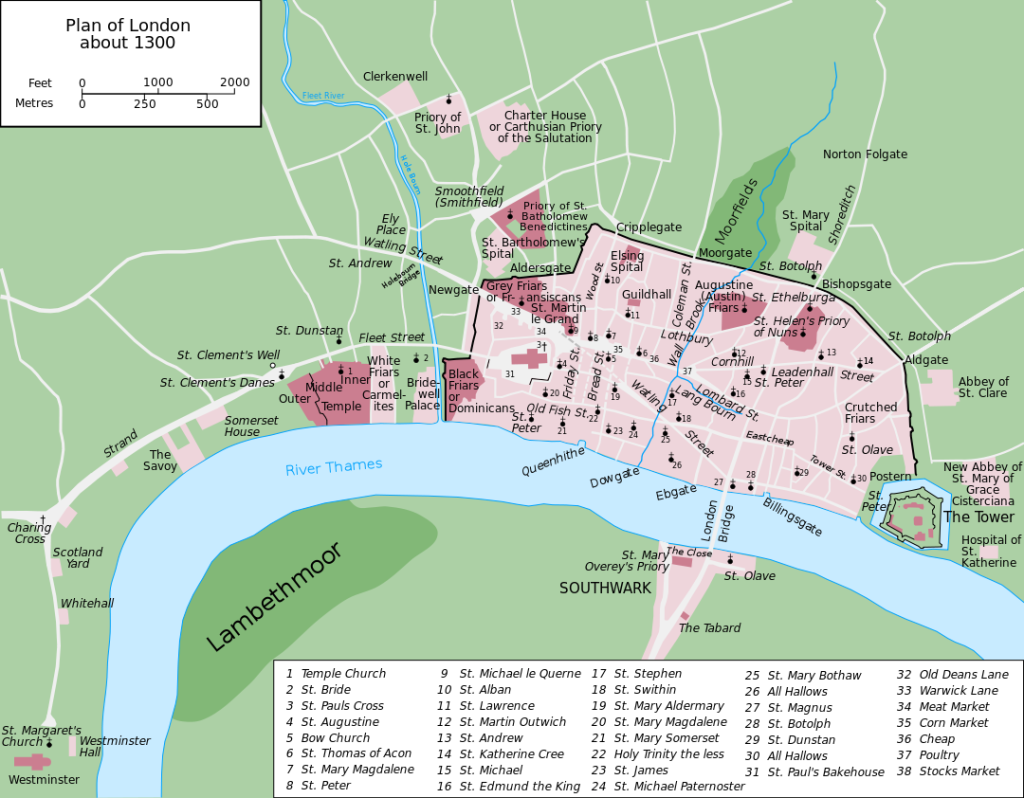
Figure 1. A map of the extent of late medieval London showing how it was mostly defined by London wall with a small part across the Thames at London Bridge. CC-BY-SA 4.0 Wikipedia User Grandiose.
During the early modern period, London outgrew the Roman wall which had defined the city limits for centuries (see map above). In 1500, its population of ~50,000 people could theoretically still fit within the “Square Mile” protected by the London Wall, but this population doubled by the middle of the century, then doubled again to ~200,000 people in 1600. By 1700, there were nearly 500,000 people living in and around the old city walls of London, in what we today might call the early modern version of the London metropolitan area and what one 1644 parliamentary ordinance called “the Cities of London and Westminster, the Hamlets of the Tower, the Borough of Southwark, and all other Parishes and places within the Line of Communication, and weekly Bills of Mortality.”2
As the expanding population of the city of London spilled over into the surrounding counties and the neighboring city of Westminster, seventeenth-century authors and government officials began to write not just of city of London but of the area “within the bills of Mortalitie.”3 Searching through the EEBO corpus reveals this formulation, time and again, sometimes used as the “etc” part of a longer list of localities and sometimes as a simple shorthand for them all. From the 1640s onwards, “within the Cities of London and Westminster or Suburbs of the same” could be considered equivalent to “within the Parishes comprised within the Bills of Mortality.”4 The city of London, as bounded by its medieval walls and liberties, still existed as a formal administrative unit. But it was also possible to think of—and write about—a greater version of London.
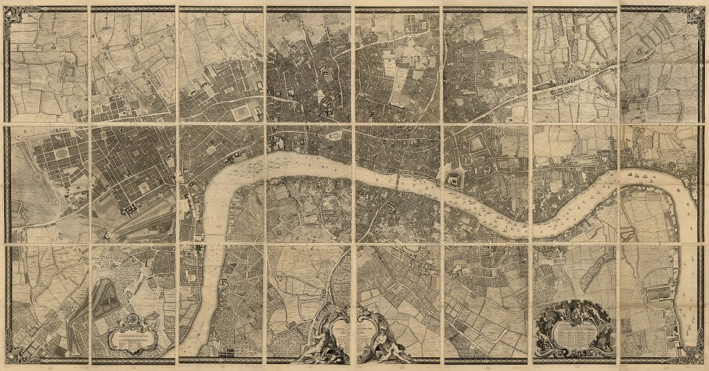
Figure 2. John Rocque’s 1746 Map of London.
The geographical scope of the bills expanded alongside the city itself in the seventeenth and early eighteenth centuries. A manuscript bill from 1582 contains 102 parishes, including 12 of the parishes “without the walls” which were formally encompassed within the liberties of the city of London. Six long-established city parishes “within the walls” presumably had no deaths that week and were not being formally excluded like extra-parochial places; a manuscript bill from 1591 contains 108 parishes, including all 96 then-extant parishes within the walls and 12 without the walls. But in 1603, the first printed bills’ geographical scope grew to include an additional 5 parishes without the walls, 6 from the counties of Middlesex and Surrey, and 2 from the city of Westminster. Through the bills, London had staked a claim to its first suburban parishes; they were not part of the city of London, but for the purpose of the bills they were part of “London”.
Over the following decades, other suburban parishes joined the bills, always carefully listed in subsections that located parishes as being within the walls, without the walls, in Westminster, or in Middlesex and Surrey. There were 130 parishes covered by the bills in the middle of the seventeenth century, when the term began to be used geographically in EEBO. After that point, most of the growth in the number of parishes came from suburban parishes spinning off daughter parishes in order to administratively cope with the exponential population growth. The bills grew to 135 parishes by the turn of the eighteenth century and reached 146 parishes in July 1746, when St Matthew Bethnal Green split from St Dunstan’s Stepney to become the last parish added to the bills during the time period covered by this project.
Though this project ends with the calendar reform of 1752, the bills survived into the nineteenth century until their increasing inaccuracy caused them to be superseded by the work of a new government agency, the General Registry Office. But as a geographical unit, the bills lived on. In 1855, they formed the basis for the newly created Metropolitan Board of Works, and eventually led to today’s Inner London. Though London has long since grown past its early modern limits, those limits have left their mark on the city’s administration that is as clear as the mark of its old Roman wall. By the end of the early modern period, London was no longer the city “within the walls.” It was the city “within the bills.”
EEBO is a paywalled resource, with access almost entirely limited to people affiliated with academic institutions that pay for EEBO subscriptions. Individual members of the public can join the Renaissance Society of America, whose benefits include EEBO access. Alternatively, as of 2020 the EEBO Text Creation Partnership has transcribed about half of EEBO and made these transcriptions freely available to the public. ↩︎
England and Wales, An Ordinance of the Lords and Commons Assembled in Parliament, for Bringing in the Arrears of the Monethly Assessment (London: Edw. Husbands, 1644), p 4, https://www.proquest.com/eebo/docview/2240891646/49520884. ↩︎
John Vicars, Gods Arke Overtopping the Worlds Waves (London: M. Simons, and J. Macock, 1645), https://www.proquest.com/eebo/docview/2248531196/99861206. ↩︎
England and Wales, A Collection of the Statutes made in the Reigns of King Charles the I. and King Charles the II. (London: John Streater, James Flesher, and Henry Twyford, 1667), https://www.proquest.com/eebo/docview/2248517597/99900150. ↩︎